About Model
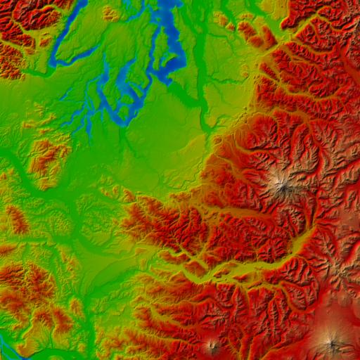
Title: Puget Sound Terrain
Author: USGS and The University of Washington
Description:
Puget Sound elevation and pseudo-color, both supplied as images.
This Puget Sound data was used as an example dataset in this paper:
- "Visualization of Large Terrains Made Easy"
- Peter Lindstrom and Valerio Pascucci
- IEEE Visualization '01 Conference Proceedings
- October 2001
Full Acknowledgements:
Data is obtained from The United States Geological Survey (USGS), made
available by The University of Washington. The dataset provided here
is a subset extracted by the paper authors from the original dataset,
which can be found here.
Data interpretation:
In the full-resolution elevation image, inter-pixel spacing is 10 meters
and each 16-bit pixel unit (0 to 65535) corresponds to 0.1 meter. The
pixel value 0 corresponds to a base elevation of 0 meters. The
lower-resolution elevation maps have been subsampled to 40 meter and
160 meter horizontal resolution.
For the texture images, each pixel corresponds to the rectangular area
spanned by four neighboring elevation samples located at the four pixel
corners. As a result, the texture images have one less row and column
than their corresponding elevation maps.
Software for reading PNG images can be
downloaded from libpng.org and
imagemagick.org.
|


 Model
Model


